According to the United Nations, more than half of the world’s population — 55% — lives in urban areas, with that figure projected to rise to 70% by the year 2050. While urban communities are vibrant centers of economic, cultural and civic activity, this vibrancy tends to be accompanied by concerns about housing affordability, aging or inadequate infrastructure, environmental impacts and more.
Such vibrancy also yields a lot of data that could provide a window onto how our urban environments function, with a view to creating more sustainable and equitable communities as well as planning for future growth. But it’s difficult to extract usable insights, let alone turn those insights into practical actions, when the data is stored in different formats, spread across different systems and maintained by different agencies.
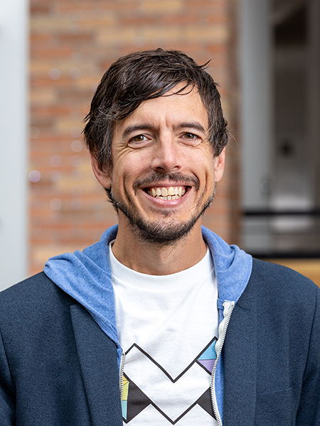
A team of researchers that includes professor Jon Froehlich, director of the Allen School’s Makeability Lab, is pursuing a more unified approach that will democratize data analysis and exploration at scale and empower urban communities. Froehlich is co-principal investigator on a new, five-year project dubbed OSCUR — short for Open-Source Cyberinfrastructure for Urban Computing — that recently earned a $5 million grant from the National Science Foundation. The project is spearheaded by the NYU Tandon School of Engineering’s Visualization Imaging and Data Analytics Research Center (VIDA) in partnership with the University of Washington and the University of Illinois Chicago.
“The true beauty and promise of OSCUR is in how it attempts to unify long-standing and deeply interconnected problems in urban science that often have disparate approaches spread across disciplines,” Froehlich said in the project announcement. “We are trying to develop standardized tools, datasets, and data standards to address problems related to climate change (e.g., urban heat island effects), walkability and bikeability, urban accessibility for people with disabilities, and more.”
To that end, Froehlich and his colleagues intend to cultivate a cohesive urban computing community spanning computer science, data science, urban planning, civil engineering, environmental sciences and other expertise. They will harness this combined wisdom to develop a set of scalable, open-source tools to enable interactive exploration and analysis of complex data, with an emphasis on findability, usability, interoperability, transparency and reproducibility. This would enable a variety of stakeholders, from researchers, to practitioners, to residents, to collaboratively address common challenges — without having to build something from scratch that may quickly become obsolete.
Communities stand to benefit from this more integrated approach in multiple ways. For example, the team envisions a set of tools that would enable agencies to make more robust use of citywide sensor data to monitor and mitigate noise pollution and improve quality of life. In addition, they could combine data from different sources to gain a more comprehensive understanding of how their infrastructure might withstand disaster — and where they may need to shore up their resilience. Such an approach would also enable communities to glean new insights into how the built environment affects pedestrian mobility, with a view to making their communities more accessible for all residents.
Froehlich is no stranger to urban accessibility issues — or collaborating with residents and decision makers to extend the real-world impact of his research. He previously co-founded Project Sidewalk, an effort that combines advances in artificial intelligence with the power of citizen science to identify and map pedestrian accessibility issues such as missing curb ramps and uneven surfaces. The initiative has spread to 21 cities in the U.S. and around the world, including Seattle and Chicago in the U.S., Mexico City, Mexico, and Amsterdam in the Netherlands. To date, contributors to Project Sidewalk have mapped more than 11,400 miles of infrastructure and contributed over one million labels — data that has been leveraged to improve city planning, build new interactive tools and train AI to automatically log accessibility issues.
“I have worked in urban computing for more than a decade,” said Froehlich. “OSCUR is one of those rare opportunities to push beyond the silos of academia and develop tools for and with communities that will take them far into the 21st century.”


