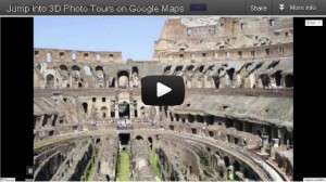
 “Photo Tours” is a spectacular addition to Google Maps, created by the Google Seattle computer vision group led by UW CSE’s Steve Seitz, and inspired by Photo Tourism (Seitz, Noah Snavely, and Rick Szeliski).
“Every year, millions of people pack their bags and head to far-off places to enjoy sites and cultures different from their own. While there, they snap photos to document their trip and share their excursions online. Yet none of these individual photos captures the experience of actually being immersed in a specific location. With today’s introduction of photo tours, a feature of Google Maps that guides you through a 3D photo scene, we’re one step closer.
“Photo tours are available for more than 15,000 popular sites around the world, from famous landmarks such as St. Mark’s Basilica in Italy to scenic treasures like Half Dome in Yosemite …
“To produce these photo tours, we use advanced computer vision techniques to create a 3D experience from public, user-contributed Picasa and Panaromio photos. We start by finding clusters of overlapping photos around major landmarks. From the photos, our system derives the 3D shape of each landmark and computes the location and orientation of each photo. Google Maps then selects a path through the best images, and adds 3D transitions to seamlessly guide you from photo to photo as if you’re literally flying around the landmark and viewing it from different perspectives.”
Learn more and try it out here.

